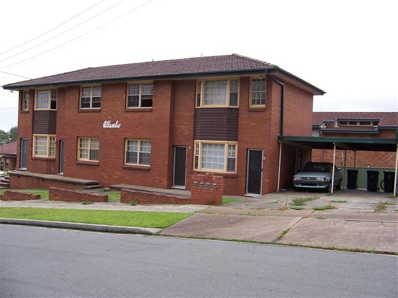
There are approximately 4,234 people living in Mayfield but… who are they?
41
52%
48%
Suburb Stats
$969/WK
$170/WK
$380/WK
Value of property in Mayfield and nearby suburbs
Mayfield
Elermore Vale
Stockton
Mount Hutton
Average Home Price$448,368Average Rental Price$334Household Size2.4
Average Home Price$447,605Average Rental Price$341Household Size2.6
Average Home Price$559,556Average Rental Price$377Household Size2.2
Average Home Price$434,595Average Rental Price$374Household Size2.5
Water Useper year per person
0.6mln. litres
State Average 0.74 mln. litres
Nat. Average 0.74 mln. litres
Greenhouse Pollutionper year per person
16.65tonnes
State Average 19.31 tonnes
Nat. Average 20.3 tonnes
Dwelling Types
95%
3%
1%
Most Common Suburb Professions
17% Technicia…
17% Managers…
15% Machinery…
14% Labourers…
Nearby shopping: warabrook
Nearby schools: mayfield west public school, waratah public school, newcastle contemporary dance academy, verto
Nearby cafes: vincent's cafe at the coliseum, tasteful creations cafe, vincents coffee, steel river take away
Nearby doctors: dr rita singh family practice - rita singh, hanbury street family practice-nymeyer linda, hanbury street family practice, surgical practice waratah
Nearby hospitals: mayfield medical connection, william lyne day hospital, mayfield podiatry clinic - newcastle
Nearby pharmacies: georgetown pharmacy, warabrook pharmacy, jon dickson pharmacy
Nearby police stations: waratah police station
Nearby parks: no.2 oval, mayfield park, cameron park, shell beach park
Nearby restaurants: sovereign inn newcastle motel, domino's pizza mayfield, kfc mayfield, the gateway inn newcastle