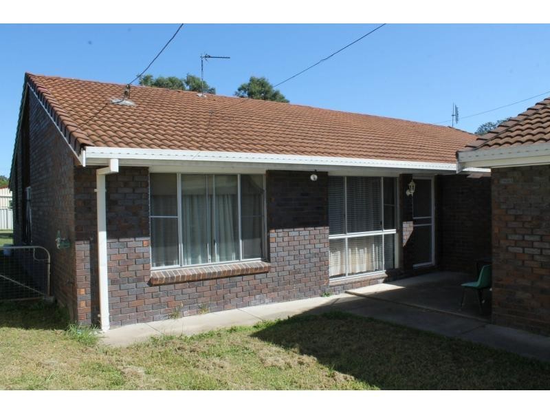
There are approximately 17,238 people living in Warwick but… who are they?
40
48%
52%
Suburb Stats
$884/WK
$215/WK
$325/WK
Value of property in Warwick and nearby suburbs
Warwick
Tansey
Taabinga
Kooralbyn
Average Home Price$314,784Average Rental Price$252Household Size2.5
Average Home Price$1,194,750Average Rental Price$0Household Size2.4
Average Home Price$322,889Average Rental Price$330Household Size2.5
Average Home Price$316,393Average Rental Price$249Household Size2.8
Water Useper year per person
0.62mln. litres
State Average 0.68 mln. litres
Nat. Average 0.74 mln. litres
Greenhouse Pollutionper year per person
17.3tonnes
State Average 18.38 tonnes
Nat. Average 20.3 tonnes
Dwelling Types
91%
6%
2%
Most Common Suburb Professions
16% Labourers…
14% Technicia…
13% Managers…
12% Clerical…
Nearby shopping: village shopping centre, rose city shopping world centre management
Nearby schools: inverness highland dance studio, a country garden early childhood centres, glennie heights preschool, warwick state high school
Nearby cafes: char-belas restaurant, brysons place, the cherry tree coffee & dining
Nearby doctors: queensland vascular: dr toby cohen, condamine medical centre - dr john kiss, friendly feet podiatry, condamine medical centre - dr louise clarke
Nearby hospitals: southern downs district health services, condamine medical centre
Nearby cinemas: warwick twin cinema
Nearby pharmacies: discount drug store, john duggan amcal chemist, warwick friendly society pharmacies, warwick friendly society pharmacy
Nearby police stations: warwick police station
Nearby parks: australiana park, leslie park, tullock park, kahlers oasis caravan park
Nearby restaurants: shalimar indian restaurant, the cherry tree coffee & dining, kfc warwick, chung hing licensed chinese restaurant