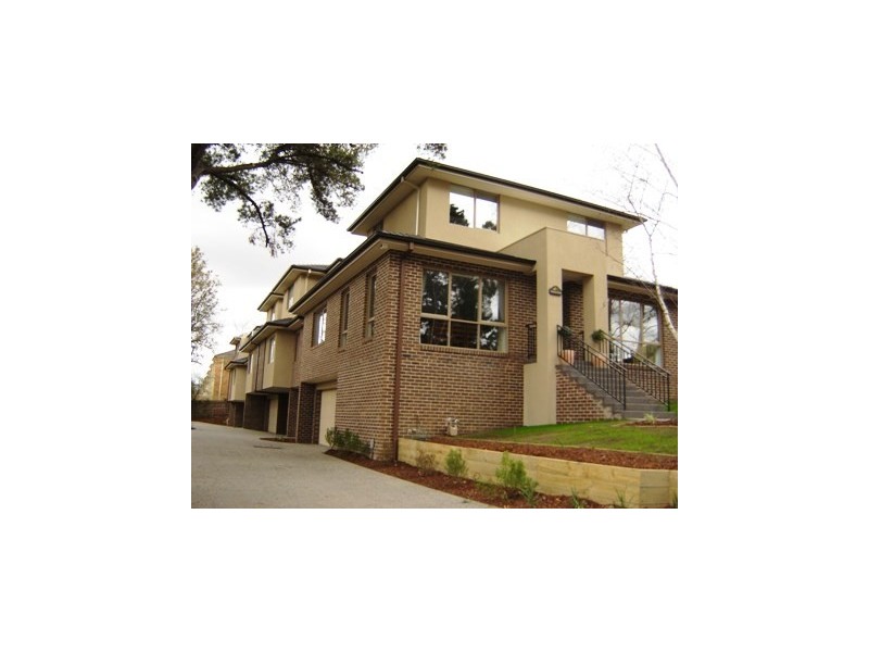
There are approximately 30,408 people living in Blackburn but… who are they?
40
48%
52%
Suburb Stats
$1387/WK
$323/WK
$497/WK
Value of property in Blackburn and nearby suburbs
Blackburn
Hughesdale
Camberwell
Surrey Hills
Average Home Price$851,214Average Rental Price$396Household Size2.6
Average Home Price$671,627Average Rental Price$400Household Size2.6
Average Home Price$1,149,488Average Rental Price$549Household Size2.7
Average Home Price$1,310,219Average Rental Price$445Household Size2.7
Water Useper year per person
0.84mln. litres
State Average 0.75 mln. litres
Nat. Average 0.74 mln. litres
Greenhouse Pollutionper year per person
21.35tonnes
State Average 19.73 tonnes
Nat. Average 20.3 tonnes
Dwelling Types
90%
9%
0%
Most Common Suburb Professions
32% Professio…
15% Clerical…
14% Managers…
11% Technicia…
Nearby train station: blackburn railway station
Nearby schools: the urban fitness club, blackburn primary school, sweetland road early learning centre, blackburn high school
Nearby cafes: the pancake parlour, bean & baker, ny bagels pty ltd
Nearby doctors: glen a hughes podiatry clinic, blackburn clinic, vision eye institute blackburn south, toothpals dental care
Nearby hospitals: colbrow medics (inc. first aid @ events), australian skin cancer group, forest hill specialists centre, forest hill family health centre
Nearby cinemas: hoyts forest hill
Nearby pharmacies: martin & diana nowak pharmacy, blackburn amcal pharmacy, nunawading pharmacy, blackburn central pharmacy
Nearby parks: ashlar crescent reserve, tunstall park, nicoll park, kalang park