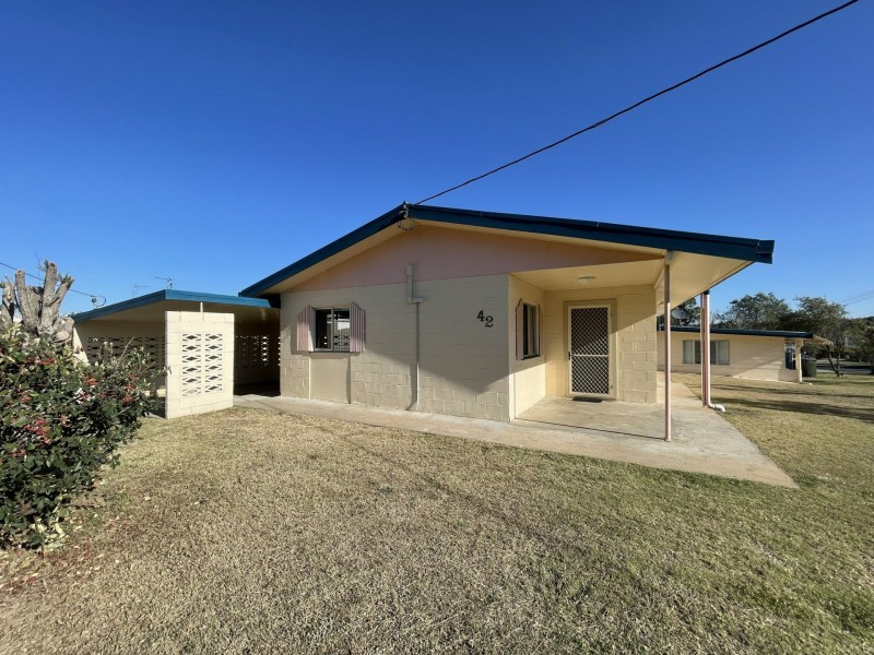
There are approximately 17,238 people living in Warwick but… who are they?
40
48%
52%
Suburb Stats
$884/WK
$215/WK
$325/WK
Value of property in Warwick and nearby suburbs
Warwick
Pilton
Birnam
Eidsvold
Average Home Price$314,784Average Rental Price$252Household Size2.5
Average Home Price$275,000Average Rental Price$0Household Size2.4
Average Home Price$0Average Rental Price$452Household Size2.8
Average Home Price$103,500Average Rental Price$188Household Size2.3
Water Useper year per person
0.62mln. litres
State Average 0.68 mln. litres
Nat. Average 0.74 mln. litres
Greenhouse Pollutionper year per person
17.3tonnes
State Average 18.38 tonnes
Nat. Average 20.3 tonnes
Dwelling Types
91%
6%
2%
Most Common Suburb Professions
16% Labourers…
14% Technicia…
13% Managers…
12% Clerical…
Nearby shopping: rose city shopping world centre management, village shopping centre
Nearby schools: australian college of phytotherapy pty ltd, glennie heights preschool, warwick state high school, warwick christian college
Nearby cafes: char-belas restaurant, the cherry tree coffee & dining, brysons place
Nearby doctors: condamine medical centre - dr evan ackermann, condamine medical centre - dr louise clarke, firm foundations podiatry, southern downs dental - dr. mike geisel
Nearby hospitals: southern downs district health services, condamine medical centre
Nearby cinemas: warwick twin cinema
Nearby pharmacies: discount drug store, john duggan amcal chemist, warwick friendly society pharmacies, warwick friendly society pharmacy
Nearby police stations: warwick police station
Nearby parks: tullock park, leslie park, kahlers oasis caravan park, victoria park
Nearby restaurants: brysons place, the cherry tree coffee & dining, palms on palmerin, char-belas restaurant