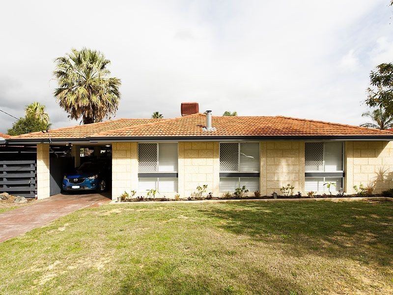
There are approximately 11,812 people living in Forrestfield but… who are they?
37
49%
51%
Suburb Stats
$1304/WK
$320/WK
$461/WK
Value of property in Forrestfield and nearby suburbs
Forrestfield
Kalamunda
Walliston
Ridgewood
Average Home Price$442,380Average Rental Price$373Household Size2.5
Average Home Price$657,522Average Rental Price$417Household Size2.7
Average Home Price$581,850Average Rental Price$432Household Size2.7
Average Home Price$427,913Average Rental Price$381Household Size2.9
Water Useper year per person
0.73mln. litres
State Average 0.72 mln. litres
Nat. Average 0.74 mln. litres
Greenhouse Pollutionper year per person
17.7tonnes
State Average 18 tonnes
Nat. Average 20.3 tonnes
Dwelling Types
97%
1%
3%
Most Common Suburb Professions
19% Technicia…
18% Clerical…
13% Machinery…
11% Labourers…
Nearby shopping: forrestfield forum & marketplace
Nearby schools: hillside christian school, woodlupine primary school, woodlupine primary school, heritage college
Nearby doctors: dentalcare of forrestfield, foothills medical group - dr. olszewski e h, forrestfield medical centre, forrestfield dental clinic - dr. west russell t
Nearby hospitals: forrestfield child health centre, mead medical group
Nearby police stations: forresfield police station
Nearby parks: connaught street reserve, dawson park, hartfield park, discovery holiday parks - perth
Nearby restaurants: commodore chinese restaurant & takeaway, yummy inn chinese restaurant, kfc, subway forrestfield
Nearby gym: jetts forestfield
Nearby mechanic: bridgestone earthmover tyres pty ltd., auto masters, forrestfield auto electrics, m'mates place
Nearby bar: bottlemart - forrestfield tavern, freshia noodles & sushi bar, hale road tavern